By Photographer Dominic Urbano
Washington’s real back roads do not have pavement.
The eastern slopes of the North Cascade Mountains are beautiful and surprisingly accessible. Tens of thousands of acres of public lands are interconnected with a network of forest service roads. It is a unique and rewarding way to travel, camp, and photograph the North Cascades. Predominately gravel and dirt, these roads network across our public lands and are fairly easy to navigate. Without much in the way of special equipment it is possible to drive from Canada to Oregon without touching more than a few miles of pavement. Some of the most beautiful scenery in the world can be viewed from the comfort of a car.
Traveling these roads is one of my favorite pastimes. There is something very rewarding about getting off the paved primary routes and heading into the valleys and across the ridges. It is fun to map out one of the multitude of possible routes using the web of forest service roads that allow for incredible access to the lands that as Americans we all own. Sure a trip from Chelan to Leavenworth via the main highways is smooth and scenic, but I would rather bump my way along a gravel back road all day long at 15 mph and take in the beauty of the Cascades at a much more leisurely pace.
For more than 25 years I have taken day trips into the hills and valleys of North Central Washington. As a student at Central Washington University in the mid 80’s I began to explore the Manashtash, Umtanum, and other surrounding areas. I loved that, with a good map, I could travel all day without having to double back. Looping routes from Ellensburg to CleElum. Picking my way across the ridges to Wenatchee or Selah. This year I decided to take a few days to start what will eventually be a complete North to South trip across Washington using only these forest service and state DNR roads. What follows is an account of the first few legs of the journey.
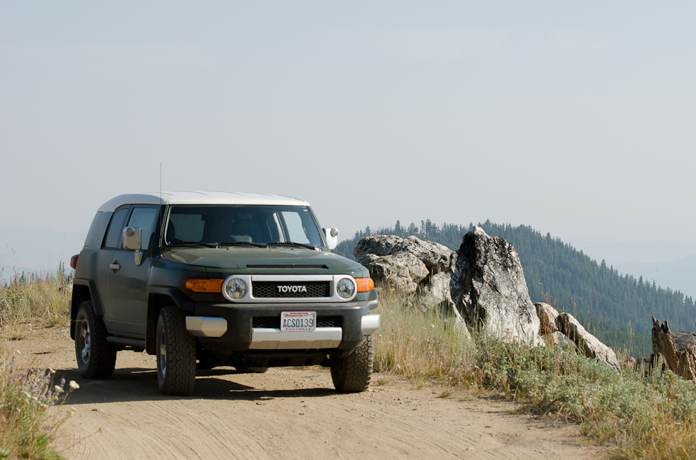
It is worth noting that the type of travel and the places I am writing about do not require any particularly special equipment. (Lifted 4×4’s etc… ) While it helps to have a vehicle with a few more inches of clearance than your grandparents Buick sedan, if one is willing to risk losing a muffler pretty much any car can negotiate these roads. While I am traveling in a Toyota FJ these days I did quite well with my ’81 Subaru back in the day and have literally seen a Buick sedan negotiate Clockum pass. (a bumpy bit of old stagecoach route between Ellensburg and Wenatchee) I am not a rock crawling 4×4 guy. That is not what this is about. If you are not in a hurry and are willing to get dirty there is a whole world of incredible country available to you.
Day 1 – 220 miles to the start… then the real reason for the trip began.
Starting off from Bellingham at around 5AM I drove 220 miles to Conconully via the North Cascades highway (State route 20) into Winthrop, then over Loop Loop pass to Okanogan and eventually Conconully. That first 220 miles was on roads that are considered some of the most scenic in Washington but it was just the beginning of the day for me and put me at the southern end of the Sinlahekin valley where the really extraordinary scenery would begin.
Where the pavement ends just outside of Conconully on Sinlahekin road I pulled to the side of the road, let some air out of my tires, and began what would be almost 600 miles of excellent driving adventure. (dropping 10lbs or so of pressure softens the tires and helps smooth the ride on what I knew would be miles and miles of washboard and otherwise bumpy road.)
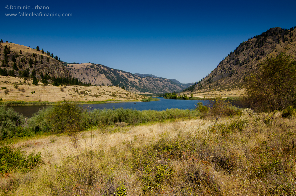
The Sinlahekin Valley is a beautiful ‘U’ shaped valley with a great mix of steep rocky slopes, pine forest, lakes, and even golden patches of dry-land wheat. It is an easy bit of wide gravel road along the valley floor that connects with the small town of Loomis to the north. A beautiful valley that ‘progress’ seems to have missed.
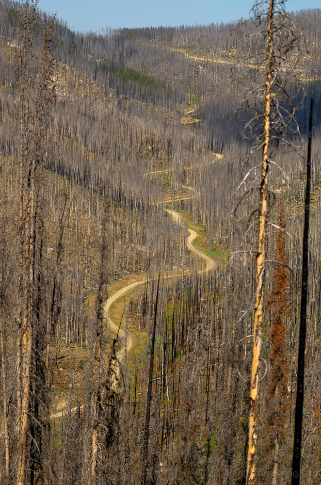
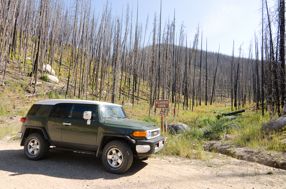
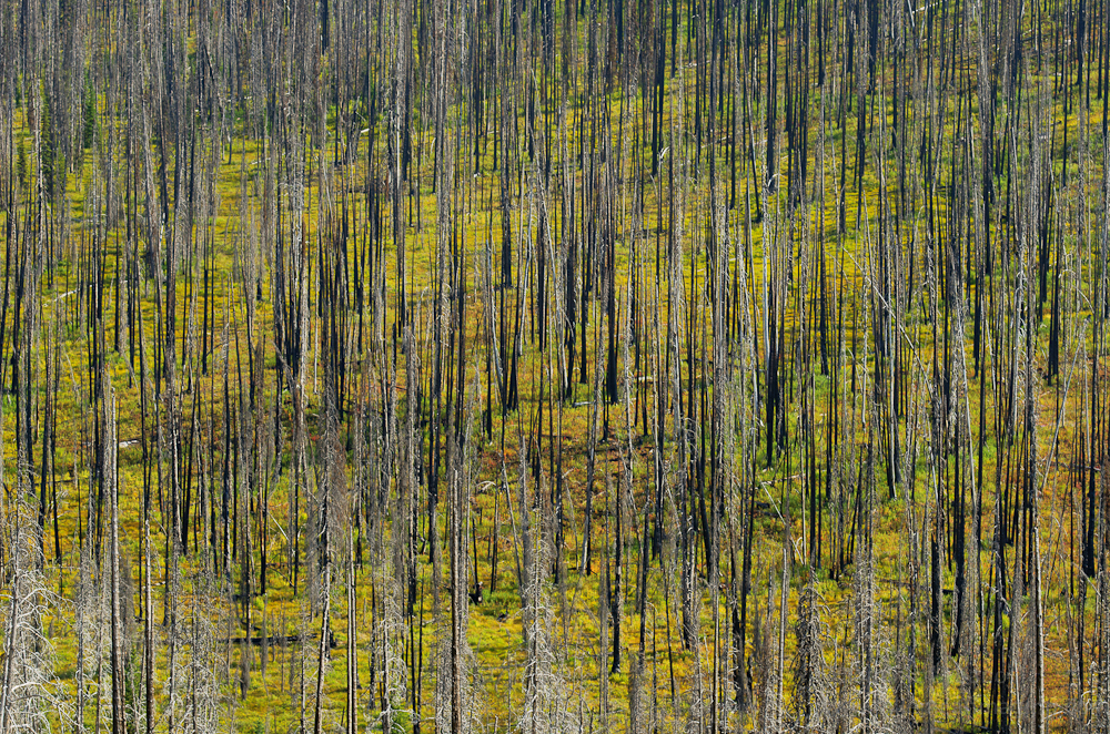
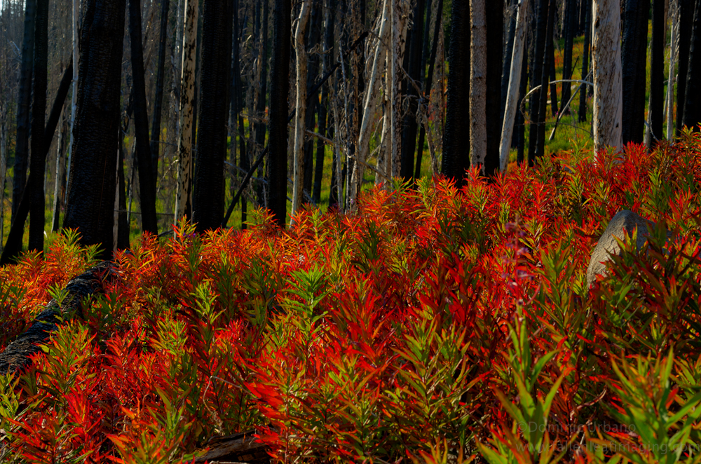
Just past Loomis a turn to the west on the Toats Coulee Road (FR 39) begins a journey deeper into the mountains. (FR 39 would remain my primary road as I looped back to the south towards Winthrop.) Shortly I was up into the mountains just south of the Pasayten wilderness. Forest fires had burned through the area some years ago and from horizon to horizon the bare sticks of burned trees created a grey black hue to what had once been green forest. It really was quite beautiful. With the trees stripped of their branches the view across the landscape was expansive, and at their base was a carpet of mountain flowers and small trees that would eventually grow to replace their parents.
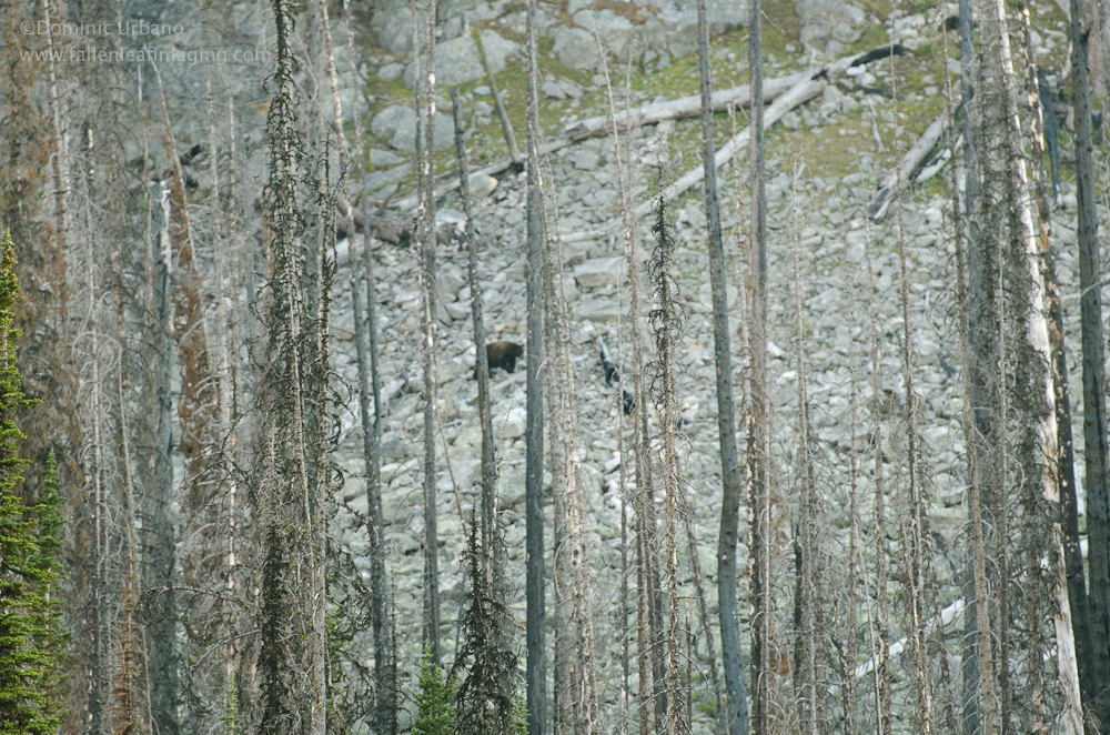
I had circled Tiffany Spring campground as my destination for the first night. Late in the afternoon I made camp and took a short hike to Tiffany Lake with my camera and tripod to see if I could catch some of the evening light. About ¾ mile from camp Tiffany Lake is a beautiful alpine lake surrounded by mountain meadows, pine forest, and rocky moraine. I happened to glance at the rocky slopes across the lake just in time to spot a large bear moving quickly towards the lake.
With the bear’s trajectory being right towards my route back to camp I decided that Mr. Bear could have the lake to himself. I snapped a few quick shots of the distant bear and beat a hasty retreat back to camp for the certain protection of the thin walls of my tent.
View North Cascade mountain loop in a larger map
THIS JOURNEY CONTINUES… CLICK HERE TO SEE DAY TWO. A ROUTE FROM WINTHROP TO CHELAN.
Leave a Reply